
Loading…
Loading…
In this lesson, students will learn how to integrate Minecraft Education activities to supplement cross curricular activities for Science units on geology and social studies units on geography to understand how rocks and landforms are formed over time.
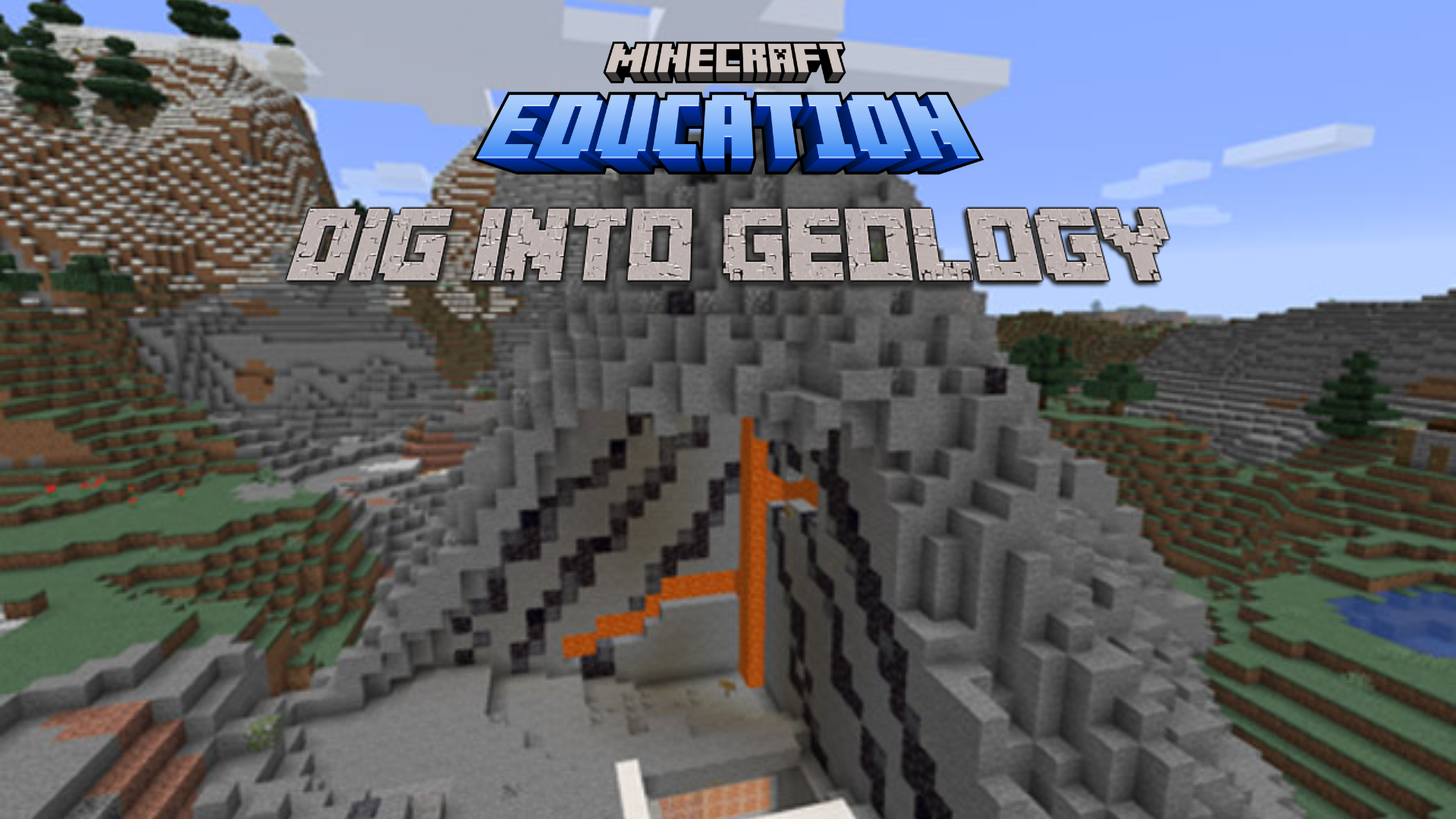
This Logics Academy Lesson, designed for Grades 4-8, will help you integrate Minecraft: Education Edition activities to supplement cross curricular activities for Science units on geology and social studies units on geography to understand how rocks and landforms are formed over time. The unit will have students also make 3d topographical maps to help understand how they are used for geographic mapping and geographic planning. Our team of Logics Academy educators will help guide you and your students through each of the activities, providing options for student reflection and sharing, leaving room for you to determine your own assessment techniques. Although this set of activities is designed for Grade 4 to 8 classes, it can be adapted for other grade levels by modifying the level of difficulty of the tasks.
➔ Rocks! Rocks! Rocks!
➔ Landforms Before Time
➔ Badlands Biome Scavenger Hunt
➔ Topographical View of the Land
➔ Why is Soil Important?
Plan to begin geology or geography units the way you always have and then when the timing is right for you, add a dash of Logics Academy Lesson to your lesson plan. You may choose to sprinkle the activities throughout the unit, or save them all until the end. That’s totally up to you.
It is recommended, however, that the activities are completed in order as they build upon each other, but if you don’t have time for all 5, no problem! Perhaps consider using the later activities as Extensions, even after the original unit has been completed.
Refer to the following pages for a detailed description of each activity.
In this video students will meet the team of co-teachers that will be working with them throughout the novel study project. Students will also learn more about each of the 5 activities that will be covered.
Introduction
Students will research and learn about the formation processes of igneous, metamorphic, and sedimentary rocks, understanding the role of pressure and force.
Students will classify rocks into the three categories and explain their characteristics and formation through a museum exhibit in Activity 1.
Students will investigate famous landforms around the world, understanding how different rocks contribute to their formation.
Through building landforms in Minecraft and presenting their creations, students will demonstrate their understanding of geographic features and the rocks involved in Activity 2.
Students will conduct a scavenger hunt in Minecraft's Badlands Biome to identify various rocks and minerals.
Using the Book & Quill, students will document their findings and explain the geological significance of each discovery in Activity 3.
Students will build topographical maps in Minecraft using color codes to represent elevation levels.
They will analyze the relationship between physical landforms and their corresponding topographical representations, demonstrating their understanding of mapping techniques in Activity 4.
Students will create cross-section views of soil layers to understand the interactions between environment, rock types, and organisms.
By examining the role of sedimentary and igneous rocks in soil formation and ecosystem support, students will demonstrate their understanding of soil importance in Activity 5.
In this video, students will research and learn about igneous, metamorphic, and sedimentary rocks and how they are formed over time because of different pressures and force. Students will share their learning and knowledge of the rock cycle by creating a museum exhibit on the 3 categories of rocks. Students will further document and be able to share their museum exhibits using the camera and portfolio.
Activity 1
Before this activity, students will research important/famous landforms around the world. In this video, an example landform from Yosemite park is created, alongside with specific labels to demonstrate how different rocks are formed. Students will use their math skills to plug in coordinates to build large areas of Minecraft using the fill command. Students will use the camera and portfolio to record important characteristics of the landform, along with slates to continue to explain their knowledge. Students will be encouraged to share their worlds in front of their class and give a 3-5 minute presentation on their world.
Activity 2
In this activity, students will complete a rocks and minerals scavenger hunt in Minecraft Education Edition’s Badlands Biome. Students will create a Geology board to track which rocks and minerals they have managed to find around the biome world. Students will document their findings using the book and quill to explain what they found, where they found it, and what it is used for. The Book & Quill allows students to share their knowledge, and to post pictures of where they located the island in the biome as well. Students can export their book and quill at the end of the lesson if desired, to be shared on the Learning Management System of the school board's choice.
Activity 3
To understand how natural rock formations are mapped, students will build a topographical map in Minecraft using the template world provided by the Minecraft Education Community. Students will build a map based on the landform provided in the world, and map it out using color codes to represent the height, and to also highlight the quickest path to scale the mountain. Students will use their photo to document how their topographical map matches up with the physical mountain, and will be encouraged to reflect on how topographical maps can be useful.
Activity 4
Select, organise and represent data and information in different forms, including by constructing special purpose maps that conform to cartographic conventions, using digital and spatial technologies as appropriate (VCGGC131)
Analyse maps and other geographical data and information using digital and spatial technologies as appropriate, to develop identifications, descriptions, explanations and conclusions that use geographical terminology (VCGGC104)
Which way would you climb a mountain? How would you know which path to plot when looking at a map? Contour maps are designed to help people understand the topography (the physical height changes) of an area. In this lesson students will be challenged to create a topographical (contour) map of a mountain in Minecraft, create a mountain from a topographical map and use the knowledge gained from these two activities to determine which path you would take up a hypothetical mountain and explain why you would take that path.
There is a complete lesson plan/outline in the "External References" section but below is the quick version. Pre lesson work: This world has 3 different identical mountains to create contour maps from, so you can group them into 3 or less groups to complete the activity. All students spawn into a starting location, there is a demo ‘mound’ to show students the task in front of them. When all students are clear on their task, students can teleport to their group location by walking through the ‘group 1, 2 or 3’ doors. As an indication, it took my 20 students just over 30 minutes to complete Activity 1: Make a Contour Map and a similar time for Activity 2: Build me a Mountain. Activity 1: Make a Contour Map Students are to create the contour map from the mountain. If your class is all in one group, I recommend placing your character top and centre of their mountain looking directly down and projecting this onto a screen so students can see the contour map as it is being created. Activity 2: Build me a Mountain The second activity gets students to create an approximation of the mountain from the contour map itself. You can get students here by teleporting all students to the Activity 2 staging area, use the teacher control platform to support you, it can be found by typing /tp 264 224 -1452 in the game. Post lesson work: Draw a random topographical map on the classroom board, ask students to think about which path they would take up the mountain, and why they would go that way. Ask students to share their path, and reasoning with the class. Make sure to discuss with students why the mountain they created in activity 2 is only ever going to be an approximation, make it clear that we only know the contour lines, that anything could be happening between them in terms of the slope.
Students will be able to explain what path they would take up a ‘random’ topographical map based on their experience in Minecraft. Students will be able to create, with reasonable accuracy, a contour map of a given mountain. Students will be able to create an approximation of the mountain from a contour map.
Building on the topography activity, students will be asked to create a cross section view of the soil that includes the interactions between environment, rock types and organisms. Students will understand the location of the surface in relation to the crust, learn about fossilization, and other processes and rock formations that would be forming between the surface and the crust. The activity will also highlight how sedimentary and igneous rocks work together to support life on earth by providing trees with the necessary room to grow, and being able to collect water from the surface of harder rock forms. The activity will culminate with students exploring and learning about Non-Player Characters (NPCs) and using the NPC to share a web resource to share their learning.
Activity 5
Take students on a field trip to local geological sites such as rock formations, caves, or fossil beds.
During the trip, guide students in identifying different types of rocks, landforms, and geological features discussed in the Minecraft activities.
Encourage students to make observations, collect samples (if permissible), and compare real-world geological formations to those created in Minecraft.
Assign students to create their own geological maps of a selected area, either real or fictional.
Provide them with topographic maps, satellite images, or aerial photographs, and ask them to identify and mark different rock types, landforms, and geological features.
Students can use symbols, colors, and labels to represent various geological elements and create a key for their maps.
Organize a hands-on activity where students bring in rocks or minerals from home or collect samples from outdoors.
Set up stations with magnifying glasses, streak plates, and other tools for students to conduct tests and identify the rocks and minerals.
Encourage students to compare their findings with what they learned in Minecraft and discuss the similarities and differences between virtual and real-world specimens
Divide students into groups and assign each group a specific geological era or period.
Task them with researching major geological events, such as volcanic eruptions, continental drift, or mass extinctions, that occurred during their assigned timeframe.
Students can create timelines using posters or digital tools, highlighting key events and their geological significance.
Challenge students to raise awareness about geological and environmental issues in their community.
Students can create educational materials such as brochures, posters, or presentations to inform others about topics such as soil erosion, rock weathering, or local geological hazards.
They can also organize events like nature walks, guest speakers from environmental organizations, or community clean-up activities to engage the broader community in understanding and addressing geological concerns.
Understanding of Rock Types and Formation:
4: Demonstrates a deep understanding of igneous, metamorphic, and sedimentary rocks, including their formation processes.
3: Shows a good understanding of rock types and formation with minor gaps in knowledge.
2: Demonstrates basic understanding but lacks clarity or detail in explaining rock types and formation.
1: Shows limited understanding of rock types and formation, with significant gaps in knowledge.
Museum Exhibit Presentation:
4: Creates a comprehensive and visually engaging museum exhibit that effectively communicates information about the rock cycle and different rock types.
3: Presents a clear museum exhibit with relevant information about the rock cycle and rock types, but may lack some depth or organization.
2: Presents a basic museum exhibit with limited detail or organization, making it somewhat difficult to understand.
1: Presents a rudimentary museum exhibit with minimal detail and organization, making it challenging to understand.
Use of Technology (Camera and Portfolio):
4: Utilizes the camera and portfolio tools effectively to document and share the museum exhibit, capturing key aspects and providing insightful reflections.
3: Makes effective use of the camera and portfolio tools to document the museum exhibit, but may lack depth in reflections.
2: Uses the camera and portfolio tools adequately to document the museum exhibit, but with limited detail or reflection.
1: Demonstrates limited use of the camera and portfolio tools, resulting in incomplete or superficial documentation.
Research and Understanding of Landforms:
4: Conducts thorough research on significant landforms and demonstrates a deep understanding of how different rocks contribute to landform formation.
3: Conducts adequate research on landforms and shows a good understanding of the relationship between rocks and landform creation.
2: Conducts basic research on landforms, with some gaps in understanding the role of rocks in landform formation.
1: Shows limited research and understanding of landforms, with significant gaps in knowledge.
Creation of Minecraft Landform:
4: Builds a detailed and accurate Minecraft representation of a landform, effectively incorporating different rock types and geological features.
3: Constructs a well-defined Minecraft landform that captures key characteristics and demonstrates an understanding of geological processes.
2: Constructs a basic Minecraft landform with limited detail or accuracy, showing some understanding of geological concepts.
1: Constructs a rudimentary Minecraft landform with minimal detail or accuracy, demonstrating limited understanding of geological concepts.
Presentation and Explanation:
4: Delivers a clear and articulate presentation, effectively explaining the chosen landform and its geological significance to the class.
3: Presents information about the landform with clarity, providing relevant explanations and engaging the audience.
2: Presents information about the landform with some clarity but may struggle to explain geological concepts effectively.
1: Presents information about the landform with limited clarity or coherence, making it challenging for the audience to understand.
Completion of Scavenger Hunt:
4: Successfully completes the scavenger hunt, locating and documenting all specified rocks and minerals within the Badlands Biome.
3: Mostly completes the scavenger hunt, finding and documenting the majority of specified rocks and minerals within the Badlands Biome.
2: Partially completes the scavenger hunt, finding and documenting some of the specified rocks and minerals within the Badlands Biome.
1: Incompletely completes the scavenger hunt, finding and documenting only a few specified rocks and minerals within the Badlands Biome.
Documentation and Explanation:
4: Provides detailed documentation of each rock and mineral found, including clear explanations of their characteristics, locations, and uses.
3: Provides adequate documentation of most rocks and minerals found, offering explanations of their characteristics, locations, and uses.
2: Provides basic documentation of some rocks and minerals found, with limited explanations of their characteristics, locations, and uses.
1: Provides minimal documentation of rocks and minerals found, with little to no explanation of their characteristics, locations, and uses.
Reflection and Application:
4: Reflects critically on the scavenger hunt experience, identifying key insights about rock and mineral distribution and applying this knowledge to real-world contexts.
3: Reflects on the scavenger hunt experience, identifying some insights about rock and mineral distribution and considering potential real-world applications.
2: Provides a basic reflection on the scavenger hunt experience, with limited insights or application to real-world contexts.
1: Offers minimal reflection on the scavenger hunt experience, with little consideration of insights or application to real-world contexts.
Accuracy of Topographical Map:
4: Constructs a highly accurate topographical map in Minecraft, effectively representing the landform provided and demonstrating a clear understanding of contour lines and elevation changes.
3: Constructs a mostly accurate topographical map in Minecraft, capturing key features of the landform provided and demonstrating an understanding of contour lines and elevation changes.
2: Constructs a somewhat accurate topographical map in Minecraft, with some discrepancies in representing the landform provided and understanding of contour lines and elevation changes.
1: Constructs an inaccurate topographical map in Minecraft, failing to effectively represent the landform provided and lacking understanding of contour lines and elevation changes.
Use of Color Codes and Annotations:
4: Uses color codes and annotations effectively to represent elevation changes and highlight key features on the topographical map, enhancing understanding and clarity.
3: Uses color codes and annotations adequately to represent elevation changes and identify key features on the topographical map, supporting understanding and clarity.
2: Uses color codes and annotations inconsistently or inaccurately, impacting the clarity and understanding of the topographical map.
1: Uses color codes and annotations minimally or not at all, resulting in confusion and limited understanding of the topographical map.
Reflection and Analysis:
4: Provides a thorough reflection on the construction of the topographical map, analyzing its accuracy and usefulness in understanding landforms and geological features.
3: Provides a reflective analysis of the construction of the topographical map, discussing its accuracy and usefulness to some extent in understanding landforms and geological features.
2: Offers a basic reflection on the construction of the topographical map, with limited analysis of its accuracy and usefulness in understanding landforms and geological features.
1: Provides minimal reflection on the construction of the topographical map, lacking analysis of its accuracy and usefulness in understanding landforms and geological features.
Creation of Cross-Section View:
4: Constructs a detailed and accurate cross-section view of the soil, effectively illustrating interactions between environment, rock types, and organisms.
3: Constructs a mostly accurate cross-section view of the soil, capturing key interactions between environment, rock types, and organisms.
2: Constructs a somewhat accurate cross-section view of the soil, with some inaccuracies or omissions in illustrating interactions between environment, rock types, and organisms.
1: Constructs an inaccurate cross-section view of the soil, failing to effectively illustrate interactions between environment, rock types, and organisms.
Understanding and Explanation:
4: Demonstrates a deep understanding of soil formation processes and interactions, providing clear and insightful explanations supported by evidence.
3: Shows a good understanding of soil formation processes and interactions, offering relevant explanations supported by evidence.
2: Demonstrates a basic understanding of soil formation processes and interactions, with some gaps or inconsistencies in explanations.
1: Shows limited understanding of soil formation processes and interactions, providing vague or incorrect explanations.
Utilization of Non-Player Characters (NPCs):
4: Effectively incorporates NPCs to share additional resources and learning about soil importance, enhancing the overall learning experience.
3: Appropriately uses NPCs to provide some additional resources and learning about soil importance, contributing to the learning experience.
2: Uses NPCs minimally or ineffectively to share additional resources and learning about soil importance, with limited impact on the learning experience.
1: Does not utilize NPCs to share additional resources and learning about soil importance, missing an opportunity to enhance the learning experience.
ISTE Standard 1: Empowered Learner: Students leverage technology to take an active role in choosing, achieving, and demonstrating competency in their learning goals in the field of geology.
ISTE Standard 3: Knowledge Constructor: Students critically curate information from digital resources to demonstrate understanding of igneous, metamorphic, and sedimentary rocks and the rock cycle.
ISTE Standard 4: Innovative Designer: Students use a variety of technologies to demonstrate creative thinking and construct knowledge of landforms and geological processes.
ISTE Standard 6: Creative Communicator: Students communicate complex ideas clearly and effectively by creating digital models of landforms and presenting them using Minecraft and other digital tools.
ISTE Standard 5: Computational Thinker: Students develop and employ strategies for understanding and solving problems in geology by using Minecraft to explore the Badlands Biome and locate specific rocks and minerals.
ISTE Standard 7: Global Collaborator: Students use digital tools to connect with geologists and other experts, sharing their findings and collaborating on understanding geological phenomena.
ISTE Standard 2: Digital Citizen: Students engage in positive, safe, legal, and ethical behavior when using technology, including respecting intellectual property rights and creating appropriate topographical maps in Minecraft.
ISTE Standard 6: Creative Communicator: Students communicate information and ideas effectively to multiple audiences using digital tools to create topographical maps and explain their significance.
ISTE Standard 3: Knowledge Constructor: Students use technology to seek out relevant information and sources to deepen their understanding of the importance of soil and its interactions with the environment.
ISTE Standard 4: Innovative Designer: Students use a variety of digital tools to design and create cross-section views of soil and its interactions with geological processes.
NGSS Standard MS-ESS2-1: Develop a model to describe the cycling of Earth's materials and the flow of energy that drives this process.
NGSS Standard MS-ESS2-2: Construct an explanation based on evidence for how geoscience processes have changed Earth's surface at varying time and spatial scales.
NGSS Standard MS-ESS2-2: Construct an explanation based on evidence for how geoscience processes have changed Earth's surface at varying time and spatial scales.
NGSS Standard MS-ESS2-3: Analyze and interpret data on the distribution of fossils and rocks, continental shapes, and seafloor structures to provide evidence of the past plate motions.
NGSS Standard MS-ESS2-1: Develop a model to describe the cycling of Earth's materials and the flow of energy that drives this process.
NGSS Standard MS-ESS2-2: Construct an explanation based on evidence for how geoscience processes have changed Earth's surface at varying time and spatial scales.
NGSS Standard MS-ESS2-2: Construct an explanation based on evidence for how geoscience processes have changed Earth's surface at varying time and spatial scales.
NGSS Standard MS-ESS2-3: Analyze and interpret data on the distribution of fossils and rocks, continental shapes, and seafloor structures to provide evidence of the past plate motions.
NGSS Standard MS-ESS2-2: Construct an explanation based on evidence for how geoscience processes have changed Earth's surface at varying time and spatial scales.
NGSS Standard MS-ESS3-3: Apply scientific principles to design a method for monitoring and minimizing a human impact on the environment.
British Columbia (BC): Grade 6 - Earth Sciences: Earth Materials (e.g., "identify the physical properties of minerals and common rocks")
Alberta: Grade 7 - Earth and Space Science: Earth's Crust (e.g., "describe how sedimentary, igneous, and metamorphic rocks are formed")
Ontario: Grade 8 - Understanding Earth and Space Systems: The Changing Earth (e.g., "describe the properties of various types of rocks and minerals")
Quebec: Secondary Cycle Two - Earth and Space Science: The Dynamic Earth (e.g., "describe the formation processes of sedimentary, igneous, and metamorphic rocks")
British Columbia (BC): Grade 7 - Earth Sciences: Earth's Surface (e.g., "demonstrate an understanding of how landforms result from the movement of Earth's tectonic plates")
Alberta: Grade 7 - Earth and Space Science: Earth's Surface (e.g., "describe the formation of landforms through processes such as erosion, weathering, and deposition")
Ontario: Grade 7 - Understanding Earth and Space Systems: The Earth's Crust (e.g., "explain how various landforms are created and changed over time")
Quebec: Secondary Cycle One - Earth and Space Science: The Earth's Surface (e.g., "describe the formation of various landforms and the processes involved")
British Columbia (BC): Grade 6 - Earth Sciences: Earth's Resources (e.g., "describe the properties and uses of different types of rocks and minerals")
Alberta: Grade 7 - Earth and Space Science: Earth's Surface (e.g., "identify common rocks and minerals found in Alberta and describe their uses")
Ontario: Grade 7 - Understanding Earth and Space Systems: The Earth's Crust (e.g., "identify common rocks and minerals and their uses")
Quebec: Secondary Cycle One - Earth and Space Science: The Earth's Resources (e.g., "identify rocks and minerals and their uses")
British Columbia (BC): Grade 6 - Earth Sciences: Landforms and Landscapes (e.g., "describe how topographic maps represent the Earth's surface")
Alberta: Grade 7 - Earth and Space Science: Earth's Surface (e.g., "interpret topographic maps and satellite images to describe landforms and landscapes")
Ontario: Grade 7 - Understanding Earth and Space Systems: The Earth's Crust (e.g., "interpret topographic maps and satellite images to identify landforms and understand elevation changes")
Quebec: Secondary Cycle One - Earth and Space Science: The Earth's Surface (e.g., "interpret topographic maps to understand landforms and elevation changes")
British Columbia (BC): Grade 6 - Earth Sciences: Soil (e.g., "describe the composition and properties of soil and their importance to plants and ecosystems")
Alberta: Grade 7 - Life Sciences: Interactions Within Ecosystems (e.g., "describe the importance of soil to the health and sustainability of ecosystems")
Ontario: Grade 7 - Understanding Life Systems: Interactions in the Environment (e.g., "explain the importance of soil to plant growth and ecosystem health")
Quebec: Secondary Cycle One - Earth and Space Science: The Earth's Surface (e.g., "describe the role of soil in supporting life on Earth and maintaining ecosystem balance")
Particle Model of Matter and Quantitative Analysis of Physical Properties:
Connection to Activities: In Activity 1 ("Rocks! Rocks! Rocks!"), students explore the particle model of matter as they learn about the formation of igneous, metamorphic, and sedimentary rocks. They analyze the physical properties of rocks and minerals, such as texture, color, and hardness, through observation and research.
Energy Transfer and Conservation:
Connection to Activities: Throughout the series, students engage in activities that demonstrate energy transfer processes, such as the formation of rocks due to pressure and heat in Activity 1. They also explore how topographical features influence energy distribution and weather patterns, connecting to Activity 4 ("Topographical View of the Land").
Weather Systems and Climate:
Connection to Activities: Activities 3 and 4 ("Badlands Biome Scavenger Hunt" and "Topographical View of the Land") allow students to explore weather patterns and climate resilience within Minecraft's virtual environments. They analyze the impact of geographic features on local weather systems and investigate the role of elevation in shaping climate conditions.
Earth Systems and Definitions/Cycles:
Connection to Activities: The series emphasizes the interconnectedness of Earth systems, such as the rock cycle explored in Activity 1 and the interactions between landforms, weather patterns, and soil composition. Students learn about geological processes and cycles through hands-on exploration and digital modeling.
Global Climate Systems, Local and Global Impacts:
Connection to Activities: In Activity 3 ("Badlands Biome Scavenger Hunt"), students investigate the global distribution of rocks and minerals within Minecraft's biomes, highlighting the interconnectedness of Earth's systems. They also analyze the impact of weather events and climate change on local ecosystems, linking to real-world examples discussed throughout the series.